Kagbhusandi tal is one of the best trek in garhwal and strenuous also. In this route one has to face big shrubs, rivers, glaciers, passes and rocky area. I suggest every body to start from bhyundhar village and get down at paika village and hire professional guide one can also hite erxper guide from Govindghat & bhyubdhar village but be careful when selecting guide . we followed the following route. Trekking distance is near about 60 - 65 km.
Day 1 : Govindghat - Bhyundar Village - RoopDhungi (12 Km.)
Day 2 : RoopDhungi - Samartoli - Raj Kharak (14 km.)
Day 3 : Raj Kharak - kagbhusandi (6 km.)
Day 4 : KagBhusandi - Panch Vinayak - Brahmakund/ bhains tal (8 Km.)
Day 5 : Brahamkund - Farswan Vinayak - Painka (15 Km.)
Day 6 : Painka village to Road Head (2.5 km.)
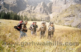
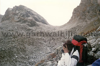
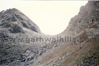
We (Rajendra, Shaili & manu Bhai) started from govindghat and hire some nepali porter cum guide from bhyundhar village. It was a simple trek till bhundhar village and little tough till roopdungi which was our first camp site. But second was tough when we had to pass big shrubs, rocks & trees. Here we had to cross a rives in two places using a single tree. After samartoli we had to cross a glacier but we crossed it easily and as I felt that that glacier portion was easy in compare to the other potion of route. After crossing this we wad to walk on boulders and moraine till kagbhusandi Tal.
Lake is beautifull and like a star fish at the height of 17000 ft. some people comeback from kagbhusandi using same route but i suggest to get down at Painka village which has more scenic beauty. After getting down from kagbhusandi tal there is a small river where we found shining stones like diamond. But I suggest not to pick up these because I collected near about 1 Kg. stone but from this place we had to climb panch vinayak which is steep climb more then 85 degree gradient and we reached at top with the helps of herbs in between I had been throwing stones one by one & at last I could take just few stones. Panch vinayak is a nice place for photography but as you could understand the situation we had to hold our breathings. One can view most of the peaks form here like Bhrigupanth, thailya sagar, chaukhanba... From Panch vinayak there is gradient slope to brahamkund which is again most beautiful area. No Kund or lake exist in this area but in 50 sq. meter area there is soft grass and water appears in many places we pitched out tent at brahmakund. Last day was from braham kund to Painka village (15 Km.) and toughest trail. From Brahamkund to farswan Vinayak is rocky area and slippery zome (2-3 km.) then gradient slope till painka village where we had to walk on rocks and that's why I suggest to start from Bhyundar because it's steep climb if one start from Painka village and even have to walk between rocks where you can get confused.


Nice information on the trek. You can also get more latest updates on Kagbhushandi trek and Valley of Flowers trek.
ReplyDeleteThanks for the info
ReplyDelete