Trek to Mandani Valley

“If you want to see heaven in the living life, visit Mandani.” A local person introduced Mandani with these words, during my Madhymaheshwar visit in 2008. I was curious  to visit mandani since than. October 2010, now it was the time to visit Mandani. We finalized the following schedule : Ransi on 6th , Paturi on 7th , Dagla on 8th , Mandani on 9th , Yeonbuk Col Base on 10th , Mahapanth on 11th and Kedarnath on 12th.
 But plans always require nature’s support for proper execution. Land slides at Selubagarh gave a 4 hrs. break to our journey and we could reach Ukhimath by 10 PM on 6th instead of Ransi. But our passion send us Uniana by 8:00 AM next morning. Devendra was waiting with his team and we reached Ransi before 9:00 AM. Ransi is better option for night stay, one will get the room in less amount and next morning he has good time to select guide / porters if required. After lunch we took blessings of Rekeshwari Devi and started day 1 trek at 11 AM. After 3-4 hrs of steep climbing we camped at Sanyara bugyal. Sanyara is an ideal and beautiful camp site which provides excellent view of Budha Madhymaheshwar, Panwashera Area, Tungnath & Panwali area.


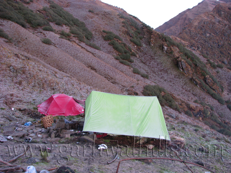
 Next day on 8th we started our trek by 8:00 AM and target was to reach Dagla after crossing Dwarakhal pass. But steep climb on dense forest, long walk on rocky terrain and rain, forced us to stay in Dophan. Today we had tough & dangerous trekking. It was a good adventurous photographic trail but rain didn’t permit me to take out my camera in many places. We camped in a area which was being used by shepherds and who had left the place now. It was not a good camp site, the land slope forced for night climbing inside our sleeping bags.


 We couldn’t see anything in evening due to rain & fog but we forgot the tiredness of last day, after seeing the morning view of mighty Chaukhamba with other Himalayan peaks. First rays of the sun convert the scenery in a beautiful painting made by supreme power.


 9th October, Weather was not favoring us today and the clouds covered the whole area after few minutes of sun rise. We left the camp site around 09:00 AM. From Dophan to Dwarakhal, the route goes though rocky terrain and mostly it’s a steep climb. After 2-3 hrs. trekking we were at Dwarakhal Pass. Himalayan peaks were hidden under the clouds layer but surrounding nature worked as a tonic. We rested here for 15 min and within 30 minutes, we were trekking in grass land after descending on bolder zone. Today’s target was to reach Mandani bugyal but our eyes were unable to find it even after 1 and 1/2 hrs. trekking from the dwarakhal, Sudddenly from  a corner we saw some tents. Oh that is mandani but it’s still a long descend trail and I could reach there after 1 hrs. trekking.


 Mandani is a 3-4 km. long and 1 km. wide valley, which starts from the base of Mandani Peak . A river flows in center. All the flowers are ended now but definitely it would be one of the beautiful valley of flower in Garhwal Himalayas. Abounds with natural beauty Mandani is a Pilgrimage place. As per the legend Goddess Durga killed the demon Mahisasur at this place and she is worshipped as Mandani Mai by the local people. An old temple is also exist here. Today’s trail was so long but the camps were setup in a good plane and soft land so I could take a good sleep and got the feeling of my bed. 


 10th October, There are two different trails to reach Kedarnath from Mandani. One goes through Simtoli Bugyal, Kham Bugyal and Kham Pass. Max. altitude in that route is 4400 mts. Second route goes via Yeonbuk Col , Bisali Col and Mahapanth Col and max. altitude is 4750 Mts. in this route. We had already decided to follow the second route so after puja and breakfast we started our trek towards Yeonbuk col base camp. 
 To reach the Yeonbuk col base camp, one has to scale the whole mandani valley, which eliminates the tiredness of previous journey and gives energy for the remaining trek. After 1-2 Hrs. relaxed journey, Approx. 4-5 km. steep climb starts and one can reach to the Yeonbuk col base camp within 2-3 hrs after crossing small rivers and rocky terrain. Soon we were in the Yeonbuk Col base camp but now the weather had changed and snow fall welcomed us when we reached at base camp. It was also a good camp site and the first highest camp site of this trek at approx. 4400 mts. but heavy snowfall forced us to go inside our sleeping bags early. It was a good evening and FM Radio was entertaining us by old songs of K.L. Sehgal, Hemant Kumar with regular updates of commonwealth games.

11th October, Our today’s trek was in the high Himalayan terrain and we had to cross three high altitude passes, Yeonbuk Col (4650 mts.), Bisali Col (4750 mts.) and Mahapanth Col (4600 mts.), which was definitely a tough task. Due to previous day snow fall and bad weather we could leave the base camp site around 10:30 AM. After 1-2 km. from base camp we were crossing the boulder zone which was filled by snow. Now Snow level was increasing and it became more than 3 feet in Yeonbuk Col.


 It became foggy but we could see the Bisali Col from here. Whole area was covered by snow. Distance between Bisali Col and Yeonbul Col is approx. 1.5 to 2 km. but it took approx. 1-2 hrs. to reach there due to snow and high altitude. All the team members were at Bisali Col by 01:00 PM. We stayed there for 30 min and follow the fwd. trail after Puja. Now the weather became bad and we were not able see beyond 50 mtr. most of the time. For approx. 1 hrs. we walked on snow field, getting down, climbing up.
 The route from Bisali col to Mahapanth was adventurous and amazing. I saw the heaven when I reached at the top of a ridge. But the weather became worst and we were struggling to find out the trail for Mahapanth Col. Suddenly  heavy snow fall started and had to camp. We setup the tents within 5-7 min and slept early after eating khichari.

 12th October, When we got up in morning we found ourselves at Mahapanth Col. Sky was clear and we saw the trail to Gandhi Sarovar in the lower valley. Today all the team members were happy as the sky was clear and our target Kedarnath was not so far. We enjoyed a nice photo session at the top and left the camp site by 11:00 AM. We had to follow a descend trail from here. The trail was covered  by snow till the next 2 km. and now we were descending in boulders area. I think that was the most dangerous patch of the whole trek. We had to descend more than 750 slope and the trail was through slippery boulders.


 We reached Kedarnath by 02:00 PM and visited Bhairav Gupha in evening. View of Kedar valley and Himalayan Peaks were amazing from Bhairav Gupha. 

Morning at Mahapanth Col

Dayara Bugyal Trek in Winter

After visiting Devaria Tal in winter, I decided to do treks in winter also as Himalayan beauty looks amazing in these days. This year I decided for a weekend trip to Dayara because I need to manage only 1 day leave (25th January), 24th and 26th were holidays. I shared my plan with Pramod, Thanna & Lokesh, everybody got ready as nobody had visited Dayara Bugyal in winter earlier. Dayara Bugyal, Located at a height of 3,048 metres above Uttarkashi, the magnificence of this rolling BUGYAL (meadow) will surprise even the most intrepid traveler. The slope of bugyal is ideal for skiing and Uttarakhand government has included it in it’s tourism development master plan. A ski resort has to be developed and rope way to be made but still Dayara is waiting for development.

Thanna & Lokesh were coming from Srinagar and thay had left Sriganr at 11:00 AM by thanna’s car, While I had to start from Roorkee and Pramod has to join me from Haridwar, He was at his home (kotdwar) and on bed rest on doctors consultation. He was facing problem in his one foot and it was a tough time for him as he was feeling pain in his foot while walking. I hired a car and planned to left roorkee by 02:00 PM, due to a training schedule. But I could leave roorkee at 02:30 PM. Pramod was waiting for me in Haridwar. It was the time of Kumbh fair, but luckily we got the clear road and crossed Rishikesh before 04:00 PM. We were hoping to reach Uttarkashi before 10:00 PM.
The Sun has set when we reached at Chamba. Chamba is a small hill station, and well connected by road from Rishikesh, Mussoorie, New Tehri & Gangotri. It’s approx. 60 km. from Mussoorie & Rishikesh. Nice place for weekend trip to Delhi & NCR people. Some good hotels are there. One can visit a day trip to Tehri Dam or Surkanda Devi Temple from here . It was completely dark when we left Chamba. We reached Uttarkashi at 09:30 PM, Lokesh & Thanna was already waiting for us. So we had a late night dinner. (As 10:00 PM is late night in mountain in winters). Uttarakshi is a famous town of Uttarakhand . It’s situated in the bank of Bhagirathi River on Gangotri Highway and is the main night stay point of pilgrims in yatra season. It’s approx. 170 km. from Rishikesh at an elevation of 1150 mts. above sea level. Two famous temple Viswanth & Kuteti Devi are located here. One can get hotels, dharamshalas & guest houses for night stay.


Next morning we got up early and left uttarkashi at 07:30 AM for Bhatwari. I have asked Ramesh to take one portor with him as we were carrying tent for night stays. Ramesh reached  Bhatwari when I was sharing our plan to forest range officer of Bhatwari for forest department formalities. Earlier we had planned to trek from Barsu, but range officer suggested me to start it from raithal, as the trek is easier and views are more beautiful from this side. So we changed our plan and make it from Raithal side.
Charhethi is approx. 2-3 km. from Bhatwari on Gangotri highway, and one has to follow a separate road for Raithal from here. We purchased ration in charhethi but I’ll suggest to keep ration from Uttarkashi because food quality was not good t here. Raithal is only 7-8 km. from charhethi and provides good view of valley. It’s 30-40 families village and population should be approx. 100 to 120. GMVN rest house is also available for night stay. Some old garhwali style houses looks beautiful. A Temple of God Someshwara is also there. If you reach uttarkashi by time, Raithal is a better option for night stay.


It was 12:30PM when we completed our village round. Lunch was unavailable as no hotel was there so we ate Maggie and started our trek by 01:00 PM. Dayara bugyal is approx. 09 km. from here. A 5-6 ft. wide trek has already made by forest department. Trek provided scenic view of valley until we entered in the dense forest. Jungle root is also beautiful and now we were getting the snow patches in the root so we hoped to see a good layer of snow in dayara. After 4-5 km. trek we reached Goi. Chhanies (Summer Huts) of raithal villagers were there but without life. If you are in a family trek than Goi is a best place for first day camping, which fulfills the basic requirement for a good camping site. Good camping ground, drinking water source, a little play ground and good view of the valley.

We had decided to stay in dayara, so left goi and followed the trek. We were walking slowly and I was the last member. After approx. an hour trek while ascending in an open place I turnaround to see the back root but I was astonished to see the panoramic evening view.  Suddenly I heard a voice “Aaram se aao sahib hum dayara pahunch gaye hain”. He was our portor who were coming back after taking water. I sat there for approx. 15 – 20 min and clicked some photographs. The ascend was ending just 50 mts. above from here but instead of dayara bugyal I saw some chhanies. I didn’t feel bad as it was evening time and I was enjoying the last sun rays on mountains. I left the chhanies and followed the trail but soon I turned back remembering the porters words.


It was small village but without life. I listened voices coming from a chhani and entered. Ramesh was preparing to light the stove, Lokesh was putting the wood pieces in fire place of kitchen. We were hungry as we didn’t have lunch. I opened my bag and distributed Matthi and bakery biscuits kept by Pranita (my wife). It gave a little relief to everybody while I missed my family. It was my first night in a chhani, which was beautiful, a small kitchen with a nice chulha (fire place), min 4 people can sit and sleep beside it. A 3 X 7’ bedroom in the back of fire place having good layer of leaves. We opened our mattresses and lokesh started maggi preparation for RC, while our porter collected snow to melt for hand washing and pot cleaning. Villagers have collected enough wood pieces inside the chhani and now fire had changed it in a warm cottage. Definetely it was a better option than tent and as per me it was free gifted night in a majestic cottage.

I got up early to enjoy the sun rise. It was a cold morning of Juanuary. Night snow fall has changed this place as a village of heaven. I was standing in front of chhani and it was a perfect place to enjoy the sunrise. It was a one of fabulous sunrise of my life. My friends came out only after complete sun rise. After daily routine job and having tea we moved to Dayara. Dayara was just 80-100 mts. from there. It was gentle and perfect slope for skiing. A thick layer of snow was looking amazing but it required more snow for skiing. We hoped that it’d be ready by end of February for skiing. After seeing the beautiful place I was not happy with my planned leaves as it was the perfect time for dayara – dodital trekking, but I was helpless due to tight schedule, so I took a 2-3 hrs. round trip in dayara. We had a good lunch at 12:00 noon and everybody was relaxing when we saw the drastic change in weather. We caught the back trail immediately and now we were walking very fast but the nature gave a gift of snowfall instead of rain for 30 minutes and we were in the uttarkashi before sunset.


Next morning Thanna and lokesh planned for Nachiketa Tal trip while their return to srinagar . I got a shared jeep for Rishikesh with Pramod. Definetely it was a short trip but it gave a lot of energy to work for next few days.